Tracked shipping to New Zealand with premium packaging for just NZ$15 

Ship to
New Zealand
0
  • argentina
  • chile
  • colombia
  • españa
  • méxico
  • perú
  • estados unidos
  • internacional

Select your country

Americas

Europe

Rest of the world

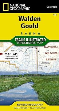
portada Walden, Gould map (National Geographic Trails Illustrated Map, 114)
Type
Physical Book
Language
English
Pages
2
Format
Paperback
ISBN13
9781566953924
Edition No.
2023rd

Walden, Gould map (National Geographic Trails Illustrated Map, 114)

National Geographic Maps (Author) · Natl Geographic Society Maps · Paperback

Walden, Gould map (National Geographic Trails Illustrated Map, 114) - National Geographic Maps

New Book Imported to New Zealand
Delivery: 27 Jul - 04 Aug Shipping: 3 to 5 business days.
NZ$ 39.67
Import costs and 15% GST included in the price ✅
NZ$ 39.67

Synopsis "Walden, Gould map (National Geographic Trails Illustrated Map, 114)"

- Waterproof - Tear-Resistant - Topographic MapNational Geographic's Trails Illustrated map of Walden and Gould combines unmatched detail with helpful information to offer an invaluable tool for making the most of your travels in North Park and the surrounding areas. Expertly researched and created in partnership with local land management agencies, this map features key points of interest including Arapaho National Wildlife Refuge; Case Flats; State Forest State Park; Delaney Butte Lakes, Owl Mountain, Brownlee, Verner, and Manville state wildlife areas; Walden and McFarlane reservoirs; and portions of the North Platte, Illinois, and Michigan rivers.Like all Trails Illustrated maps, this map features detailed topography with shaded relief, elevations, and clearly defined, color-coded boundaries for parks, forests, public lands, wilderness areas, and wildlife management areas. Road types are differentiated, so you know if the route you choose is a paved, four-wheel-drive, or high-clearance road. Trail use is easy to identify, whether you're hiking, biking, snowmobiling, or cross country skiing. The Case Auto Tour and Cache La Poudre -- North Park Scenic Byways are noted for those wishing to take in the scenery by car. Recreation features are clearly marked, including campgrounds, trailheads, fishing areas, boat launches, interpretive trails, and yurts.Every Trails Illustrated map is printed on "Backcountry Tough" waterproof, tear-resistant paper. A full UTM grid is printed on the map to aid with GPS navigation.Other features found on this map include: Routt National Forest.Map Scale = 1:40,680Sheet Size = 22" x 32"Folded Size = 4" x 7.5"

Customers reviews

Frequently Asked Questions about the Book

All books in our catalog are Original.
The book is written in English.
The binding of this edition is Paperback.

Questions and Answers about the Book

Do you have a question about the book? Login to be able to add your own question.

Opinions about Bookdelivery

More customer reviews