Tracked shipping to New Zealand with premium packaging for just NZ$15 

Ship to
New Zealand
0
  • argentina
  • chile
  • colombia
  • españa
  • méxico
  • perú
  • estados unidos
  • internacional

Select your country

Americas

Europe

Rest of the world

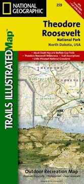
portada Theodore Roosevelt National Park (National Geographic Trails Illustrated Map)
Type
Physical Book
Year
2002
Language
English
Pages
1
Format
Map
ISBN13
9781566954648
Edition No.
2002

Theodore Roosevelt National Park (National Geographic Trails Illustrated Map)

National Geographic Maps (Author) · National Geographic Maps · Map

Theodore Roosevelt National Park (National Geographic Trails Illustrated Map) - National Geographic Maps

New Book Imported to New Zealand
Delivery: 27 Jul - 04 Aug Shipping: 3 to 5 business days.
NZ$ 39.67
Import costs and 15% GST included in the price ✅
NZ$ 39.67

Synopsis "Theodore Roosevelt National Park (National Geographic Trails Illustrated Map) "

• Waterproof • Tear-Resistant • Topographic MapExpertly researched and created in partnership with local land management agencies, National Geographic's Trails Illustrated map of Theodore Roosevelt National Park includes both the north and south units of the park, as well as the Magpie and Elkhorn section of the Little Missouri Grassland. In the North Unit of the park, the map includes the Maah Daah Hey Trail, Little Mo Nature Trail, Caprock Coulee Nature Trail, Buckhorn Trail, Achenbach Trail, and Juniper camping area. The Maah Daah Hey Trail then winds south through the Little Missouri National Grassland, meeting Bennett Trail, then passes into Magpie, then Elkhorn, then into the South Unit of Theodore Roosevelt National Park. Map features in the South Unit include Ridgeline Nature Trail, Coal Vein Nature Trail, Buck Hill Trail, Wind Canyon Trail, Jones Creek Trail, Paddock Creek Trail, Talkington Trail, and the Petrified Forest. Also included in this portion of the map is Buffalo Gap Trail, Roundup Horse Camp, Cottonwood, Painted Canyon, Sully Creek State Park, and the town of Medora.The clearly marked trails include mileage between intersections and trail summaries provide distance and difficulty for suggested hikes. Helpful material about the park, backcountry use, agency contact information, and safety tips will prove invaluable in your exploration of the park. The map base includes contour lines and elevations for summits and passes. Some of the many recreation features include campgrounds, trailheads, interpretive trails, points of interest, horse camps, and river access.Every Trails Illustrated map is printed on "Backcountry Tough" waterproof, tear-resistant paper. A full UTM grid is printed on the map to aid with GPS navigation.Other features found on this map include: Little Missouri Badlands, Sperati Point, Theodore Roosevelt National Park.Map Scale = 1:40,000Sheet Size = 37.75" x 25.5"Folded Size = 4.25" x 9.25"

Customers reviews

Frequently Asked Questions about the Book

All books in our catalog are Original.
The book is written in English.
The binding of this edition is Map.

Questions and Answers about the Book

Do you have a question about the book? Login to be able to add your own question.

Opinions about Bookdelivery

More customer reviews