Tracked shipping to New Zealand with premium packaging for just NZ$15 

Ship to
New Zealand
0
  • argentina
  • chile
  • colombia
  • españa
  • méxico
  • perú
  • estados unidos
  • internacional

Select your country

Americas

Europe

Rest of the world

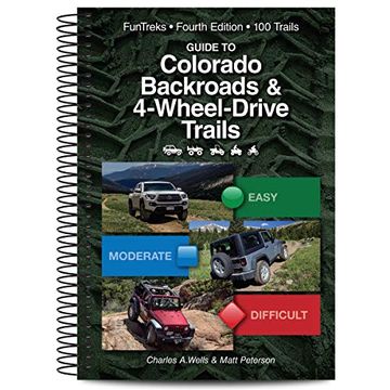
portada Guide to Colorado Backroads & 4-Wheel-Drive Trails
Type
Physical Book
Publisher
Year
2019
Language
English
Pages
236
Format
Spiral Format
Dimensions
22.6x15.2x2.3 cm
Weight
0.70 kg.
ISBN13
9781934838266
Edition No.
0004

Guide to Colorado Backroads & 4-Wheel-Drive Trails

Charles a. Wells (Author) · Matt Peterson (Author) · Funtreks Inc. · Spiral Format

Guide to Colorado Backroads & 4-Wheel-Drive Trails - Wells, Charles a. ; Peterson, Matt

Cheaper New Book Imported to New Zealand
Delivery: 29 Oct - 12 Nov Shipping: 11 to 17 business days.
NZ$ 76.27
Faster New Book Imported to New Zealand
Delivery: 02 Nov - 10 Nov Shipping: 13 to 15 business days.
NZ$ 106.15
Import costs and 15% GST included in the price ✅
NZ$ 76.27

Synopsis "Guide to Colorado Backroads & 4-Wheel-Drive Trails "

This is it Colorado s top-selling 4x4 guidebook, the one everyone tells you to get if you re going off-roading in Colorado. Completely redone, this fourth edition is more fun than ever. All trails have been freshly redriven and updated. Inside you ll find 100 of the best trails in Colorado. All are west of I-25 and south of I-70. Many are convenient to Denver and the Front Range. (For trails north of I-70 see FunTreks Guide to Northern Colorado Backroads & 4-Wheel-Drive Trails, 4th Edition.) Whether you are a newcomer to 4-wheeling or an experienced veteran, we guarantee you ll have fun. The book features 26 easy family fun runs, 32 moderate sport utility adventures and 42 difficult hard-core challenges. Ninety-two trails are open to unlicensed ATVs, side-by-sides, and dirt bikes. The book features 8 new trails not in the previous edition. Six are on the Western Slope in the Grand Junction area. Each trail features a turn-by-turn mileage log with GPS waypoints referenced to a custom map. The trail description includes an overview, a detailed rating, time and distance driven, highest elevation, contact phone numbers to call for trail conditions, best times to go and directions to the start. Also included are reverse mileages and historical highlights. In total, the book includes 109 maps and over 520 photos. Visit FunTreks website for free GPS data for individual trails. We also sell SD cards for each of our books for use in Garmin NUVI and Garmin handheld devices. See our new iPhone app and learn how to get FunTreks GPS on Android devices.

Customers reviews

Frequently Asked Questions about the Book

All books in our catalog are Original.
The book is written in English.
The binding of this edition is Spiral Format.

Questions and Answers about the Book

Do you have a question about the book? Login to be able to add your own question.

Opinions about Bookdelivery

More customer reviews