Tracked shipping to New Zealand with premium packaging for just NZ$15 

Ship to
New Zealand
0
  • argentina
  • chile
  • colombia
  • españa
  • méxico
  • perú
  • estados unidos
  • internacional

Select your country

Americas

Europe

Rest of the world

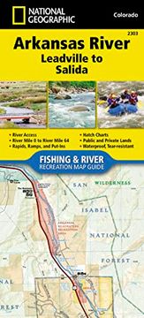
portada Arkansas River, Leadville to Salida map (National Geographic Fishing & River map Guide, 2303)
Type
Physical Book
Language
English
Pages
48
Format
Paperback
ISBN13
9781566957038
Edition No.
2017th

Arkansas River, Leadville to Salida map (National Geographic Fishing & River map Guide, 2303)

National Geographic Maps (Author) · Natl Geographic Society Maps · Paperback

Arkansas River, Leadville to Salida map (National Geographic Fishing & River map Guide, 2303) - National Geographic Maps

New Book Imported to New Zealand
Delivery: 27 Jul - 04 Aug Shipping: 3 to 5 business days.
NZ$ 39.67
Import costs and 15% GST included in the price ✅
NZ$ 39.67

Synopsis "Arkansas River, Leadville to Salida map (National Geographic Fishing & River map Guide, 2303)"

- Waterproof - Tear-Resistant - Fishing & River MapThe Arkansas River, Leadville to Salida Fishing & River Map Guide is designed to be the perfect companion to anyone recreating on the upper Arkansas. On the upper river, there is a great distinction to be drawn between the waters above and below the confluence with Lake Creek. This is partly one of topography--above this point the river is largely an oxbowed meadow stream, while below it flows through the steep and confined channel of the Granite Gorge and on through the several canyons that follow. But it is also differentiated by its hydrology--the flow through the Hayden Meadows reach above Lake Creek is almost totally natural, with a short but intense spring runoff, while the river below that confluence is augmented by releases of water from both Twin Lakes and Turquoise reservoirs. As a result of these impoundments, higher flows are common below Lake Creek in general and throughout the summer in particular.Each Fishing & River Map Guide includes detailed river maps at a scale of 1 inch = 1/2 mile. At this scale every turn in the river and rapid is clearly shown and labeled. Each page is centered on the river and overlaps with the adjacent pages so finding any location along the river is easy. The maps include rapids, river miles, access points, private and public lands, gaging stations, recreation sites, and more.Greg Felt, a renowned fly fishing guide on the Arkansas River, has written the introduction as well as descriptions of specific fly fishing strategies and seasonal fluctuations found on the river. Also included are stream flow charts, hatch charts, and a table of river access points.More convenient and easier to use than folded maps, but just as compact and lightweight, National Geographic's Fishing & River Map Guide booklets are printed on "Backcountry Tough" waterproof, tear-resistant paper with stainless steel staples. A full UTM grid is printed on the map to aid with GPS navigation.Map Scale = 1:31,680Folded Size = 4.25" x 9.38"

Customers reviews

Frequently Asked Questions about the Book

All books in our catalog are Original.
The book is written in English.
The binding of this edition is Paperback.

Questions and Answers about the Book

Do you have a question about the book? Login to be able to add your own question.

Opinions about Bookdelivery

More customer reviews